"Confidence is highest from Tuesday, March 24, through Thursday morning, March 26, with models aligning on a warm front Tuesday followed by a colder frontal passage Wednesday into early Thursday."
"Snow levels climb to roughly 6,500 to 7,500 feet during the warm part of the storm, with early snow coming in dense, while colder air late Wednesday causes snow levels to crash toward 3,000 to 5,000 feet."
"Once the front clears, models indicate a ridge rebuilding from Friday through Sunday, favoring dry weather, lighter wind, and above-normal temperatures, leading to increasingly soft snow conditions."
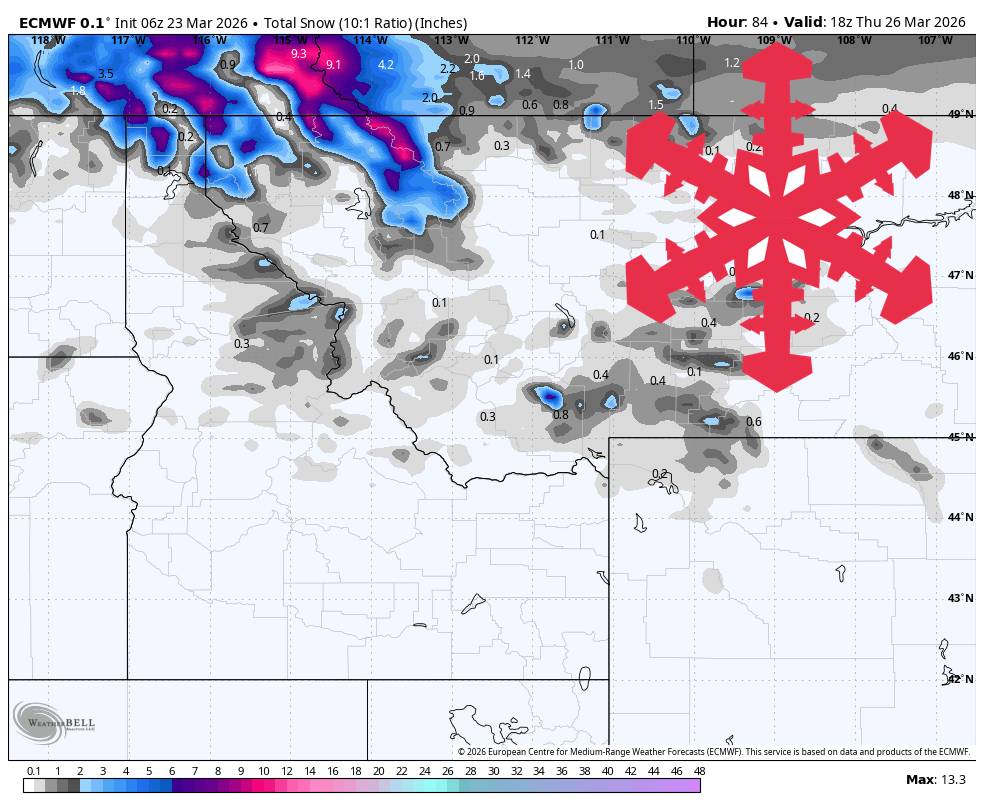
Spring weather remains warm through Tuesday, transitioning to a windy front that brings rain and high-elevation snow to north Idaho and northwest Montana. Ski areas further south and east remain mostly dry. Precipitation is expected mainly from Schweitzer to Whitefish, with snow levels rising to 6,500 to 7,500 feet before dropping to 3,000 to 5,000 feet. After the front, a ridge will bring dry weather and above-normal temperatures, leading to softer snow conditions by the weekend.
Read at SnowBrains
Unable to calculate read time
Collection
[
|
...
]