"PDO is a pattern of ocean-atmosphere climate variability that, when positive, shows an increase in rain and snow in Alaska. When it is positive, AK is 3x more likely to see low pressure storms. In it's most basic form, this system is pretty simple: A semi-permanent low pressure center called the Aleutian Low gathers storms, the Polar Jet Stream consistently blows those storms into mainland Alaska."
"The Aleutian Low is a semi-permanent low pressure center located near the Aleutian Islands of AK during the winter. It is one of the main centers of action in the atmospheric circulation of the Northern Hemisphere. Low pressure = storms. The Polar Jet Stream is belt of powerful upper-level winds that sits at mid-latitudes in Alaska. The polar jet streams blow faster than the subtropical jet stream we are used to in the Lower 48."
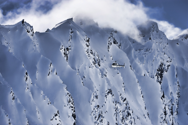
Alaska receives some of the highest snowfall on Earth, with the Chugach Range offering world-class skiing and snowboarding, attracting professionals each spring. Sparse measurement stations leave exact totals uncertain across remote icefields. A combination of atmospheric systems drives heavy snow: a semi-permanent Aleutian Low gathers storms, while a strong Polar Jet Stream funnels them into mainland Alaska. When the Pacific Decadal Oscillation (PDO) is in its positive phase, Alaska experiences more frequent low-pressure storms—approximately three times as likely—enhancing precipitation. Together the Aleutian Low, Polar Jet Stream, and positive PDO define a persistent storm track that fuels massive snowfall.
Read at SnowBrains
Unable to calculate read time
Collection
[
|
...
]