"If you turned on the Weather Channel or your local news, and the meteorologist was pointing out, Oh, it's going to be raining in this area...,' those are the same radars that we use as ecologists to quantify birds moving through the atmosphere, says Kyle Horton, a Purdue University ecologist, who studies migratory birds and is a member of BirdCast, a collaboration that tracks bird migration."
"Radar systems send out radio waves and then record any energy that is reflected back to their receivers. Information about how long it takes for the signal to return to the receiver is used to calculate how far away something is from the radar tower. Just like radar beams reflect off of the water droplets in brewing storms, they reflect off migrating birds."
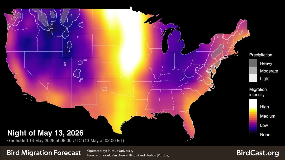
"Horton's lab and the BirdCast collaboration use radar data to study bird migration patterns and generate a number of bird tracking maps that give birders a glimpse into how many birds are on the moveand offer birding forecasts for the next few days."
"Across the top of this radar loop, rainclouds move from west to east. The growing blob of blue and green around the radar shows birds in flight. When radar aeroecologists like Horton first look at radar data,"
Hundreds of millions of birds migrate to northern breeding grounds, often traveling hundreds to thousands of miles and stopping to refuel. Most movement occurs at night, which is why experts recommend turning off unneeded lights during migration season. Bird enthusiasts can track these migrations using radar systems similar to those used for storms. Radar sends radio waves and measures reflected energy to determine distance from the radar tower. Reflections from migrating birds appear in radar imagery, forming visible blobs that indicate birds in flight. Radar data is used by ecologists and BirdCast to study migration patterns and generate bird tracking maps and forecasts for the next few days.
Read at www.scientificamerican.com
Unable to calculate read time
Collection
[
|
...
]