#hurricane-humberto
#hurricane-humberto
[ follow ]
#tropical-storm-imelda #fujiwhara-effect #hurricane-imelda #storm-amy #weather-warnings #rip-currents


fromIrish Independent
7 months agoStorm Amy: Status Orange warning for one county as Met Eireann issues Status Yellow wind alert for Ireland and rain warning for 14 counties
So, with that rain tomorrow, we do have a Status Yellow rain warning in effect from 6am to 8pm tomorrow for much of Munster, Connacht, and then counties in Leinster and Ulster as well. Then on Friday, we'll see Storm Amy, and at the moment now it's a feature that's being fuelled by tropical remnants in the tropic west Atlantic, and when that warm, moist, tropical air meets the cooler air, after it transitions it then gets picked up by a strengthening jet stream which is sending it across to us, across the Atlantic. It is forecast to rapidly intensify, becoming Storm Amy as it reaches us then on Friday.
Miscellaneous


fromIrish Independent
7 months agoEx-hurricane Humberto tracks our way, threatening strong winds and heavy rain by Friday
Humberto - which last weekend was classified as a Category-5 hurricane with devastating 260kmh winds - is not expected to make landfall in the US after forming in the Caribbean. Instead, it is expected to sweep across the Atlantic this week, weakening as it travels, but potentially reaching Ireland on Friday. As Humberto departs the Caribbean, yet another major storm is forming, with this tropical depression expected to expand into Storm Imelda.
Miscellaneous
fromwww.theguardian.com
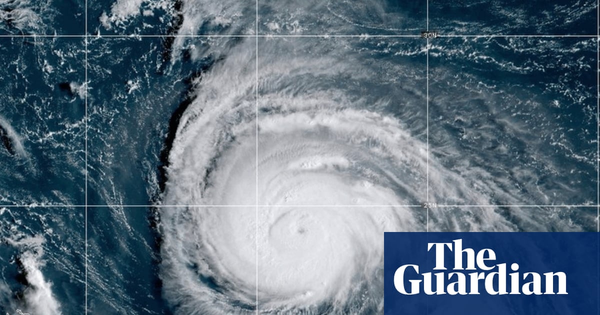
7 months agoUS on watch as impending Tropical Storm Imelda threatens south-east
A weather system that is forecast to become Tropical Storm Imelda later on Sunday before approaching the coast of South Carolina as a hurricane in the coming days was causing disruption in the Bahamas and nearby islands. Meanwhile, Hurricane Humberto weakened very slightly but remained a strong category 4 storm in the Atlantic, threatening Bermuda. South Carolina's governor, Henry McMaster, urged people to monitor the weather closely and stay alert.
Environment
fromwww.mercurynews.com
7 months agoHumberto becomes Category 4 hurricane; second Caribbean storm strengthening
Dangerous tropical weather brewed Saturday in the Atlantic Ocean with Humberto intensifying into a powerful Category 4 hurricane and a weather system taking aim at the Southeast U.S. Hurricane Humberto had maximum sustained winds of 145 mph Saturday, according to the Miami-based National Hurricane Center's latest advisory. The storm was located about 375 miles northeast of the northern Leeward Islands. It was moving west at 6 mph.
Environment
Science
fromwww.scientificamerican.com
7 months agoThe Forecast Is Cloudy as Meteorologist Watch Two Storms Dance in the Atlantic
Potential Tropical Cyclone Nine near Cuba and the Bahamas has a 90 percent chance of becoming Tropical Storm Imelda, with an uncertain track and potential Carolinas flooding.
US news
fromwww.pilotonline.com
7 months agoHurricane Humberto and a tropical disturbance to impact the Caribbean and possibly the Southeast US
Hurricane Humberto reached 90 mph and may become major; a nearby tropical disturbance threatens heavy rain, flooding, and coastal impacts in Caribbean and U.S. Southeast.
[ Load more ]