#usgs
#usgs
[ follow ]


fromSFGATE
2 months agoMagnitude 4.3 temblor felt in North Bay
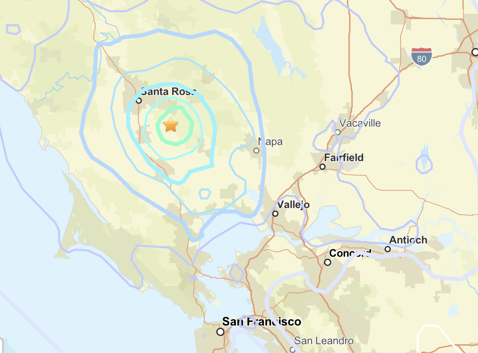
An earthquake measuring at a preliminary magnitude of 4.3 shook Sonoma County on Saturday morning around 9:22 a.m., according to the U.S. Geological Survey. The temblor struck about 3.7 miles north-northwest of the Geysers, close to Healdsburg in the North Bay. Originally the quake was measured at a preliminary magnitude of 3.9 but that was revised to a preliminary 4.3 later in the morning by the USGS.
US news


fromwww.mercurynews.com
4 months agoTwo earthquakes rattle San Ramon region
Two earthquakes struck the San Ramon region Saturday night, just one day after a swarm of six quakes shook the area, authorities said. The first earthquake, a magnitude 3.9, hit at 6:31 p.m., according to the United States Geological Survey. It was centered three miles southeast of San Ramon and 3.3 miles north of Dublin. The second earthquake was a magnitude 3.0 that was centered 2.7 miles southeast of San Ramon.
California


fromFlowingData
5 months agoGeologic map of the United States' surface
The Earth's Surface geology layer depicts geologic units exposed at the Earth's surface in the conterminous United States, ranging in age from Quaternary glacial deposits and alluvium to Precambrian crystalline bedrock. In the U.S. West and Southeast, the map is a composite of 29 state geologic maps depicting geology at the Earth's surface. In the glaciated region of the Midwest and Northeast, the map is a composite of 21 state geologic maps depicting pre-Quaternary rocks ("bedrock"), 8 state geologic maps depicting Quaternary deposits, and 18 USGS Quaternary Atlas Series maps depicting Quaternary deposits. The Quaternary Atlas maps were used where modern state geologic maps were not available.
Science

fromMail Online
7 months agoHaze over America's deadliest volcano sparks fears of an eruption
The USGS issued a statement, saying that strong easterly-southeasterly winds in the vicinity of Mount St Helens had picked up 45-year-old loose volcanic ash. 'This phenomenon is not the result of recent volcanic activity and occasionally occurs during times of high winds and dry snow-free conditions in the Mount St Helens area,' the agency added. 'No eruption is in progress and Mount St Helens remains at Aviation Color Code GREEN and Alert Level NORMAL.'
Environment
fromMail Online
7 months agoPowerful earthquake hits near Alaska sparking fears of a tsunami
The US Geological Survey (USGS) detected a 5.2 magnitude quake at 1am local time (5:02am ET) in Nikolski. The USGS shows a 60 percent chance of a 3-magnitude or greater hit near the epicenter in the next week, along with a small two percent chance of another 5-magnitude or greater. While there was no immediate tsunami warning, online reports suggested residents and authorities are on edge as they assess the potential impacts.
World news


[ Load more ]