#heavy-snowfall
#heavy-snowfall
[ follow ]
#high-winds #noreaster #winter-storm #blizzard #blizzard-warnings #power-outages #travel-disruptions


fromSnowBrains
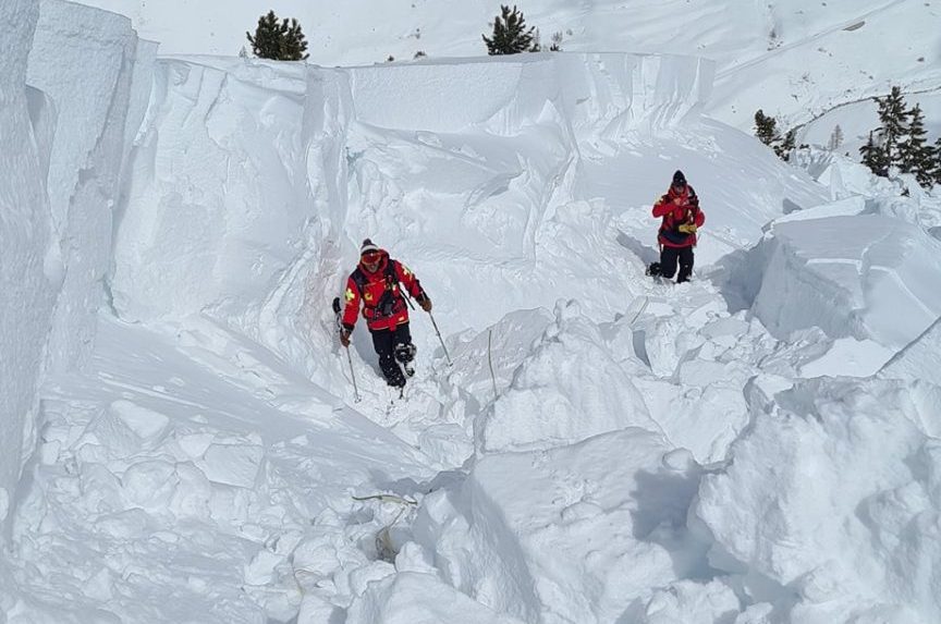
2 months ago[PHOTOS] Snow Buries French Alps as Massive Storm Dumps 6 Feet of Powder - SnowBrains
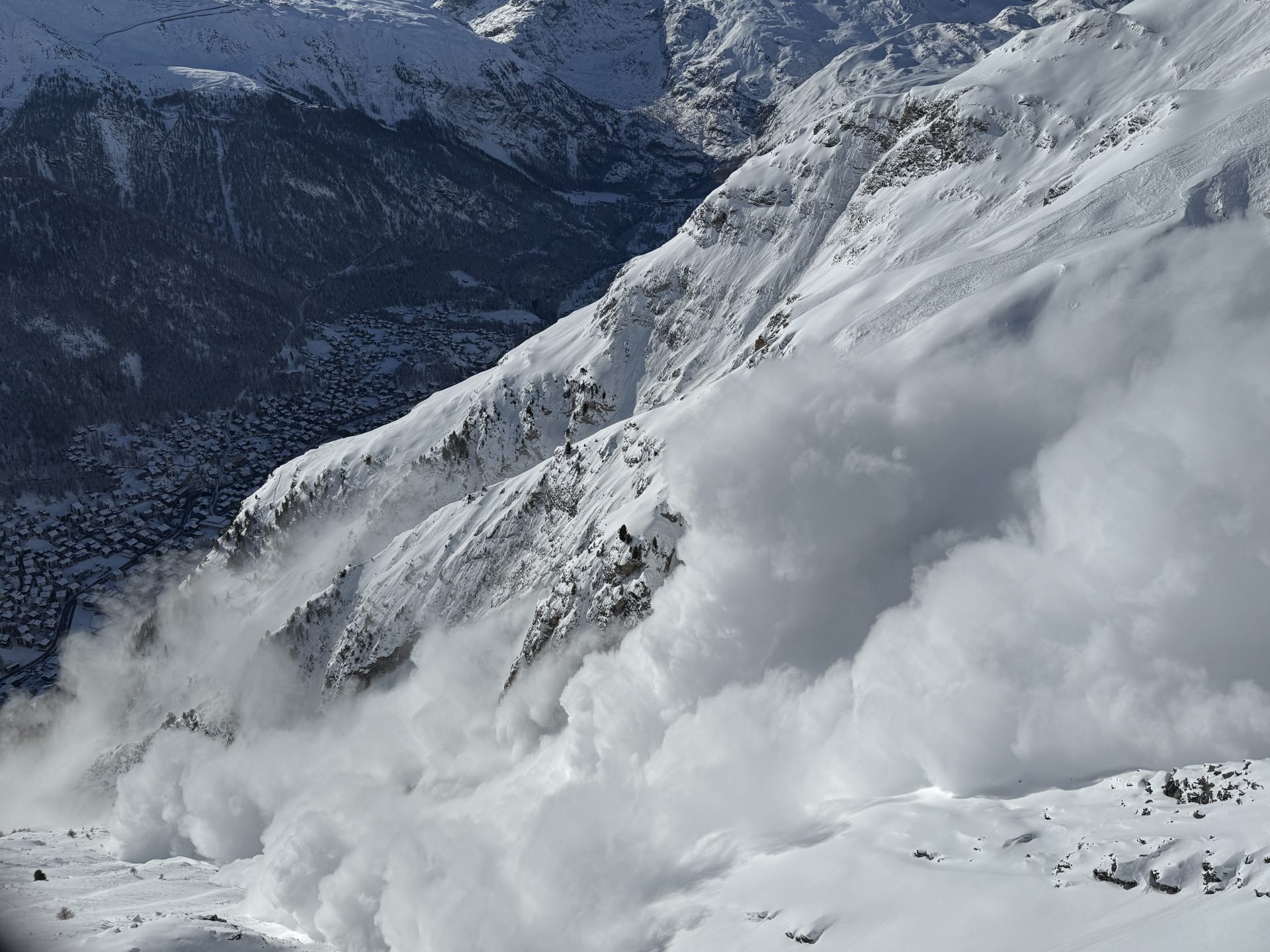
Snowfall in France this week has been huge, with some resorts seeing more than 2 meters (6.6 feet) in the last five days. A massive winter storm hammered the French Alps from February 10-13, unleashing monster snowfall that has buried resorts and reshaped the mountain landscape just days before Valentine's Day weekend. Across the Northern Alps - including iconic resorts in Haute-Savoie, Savoie, and Isère - weather stations reported extraordinary snow totals.
Snowboarding
fromSnowBrains
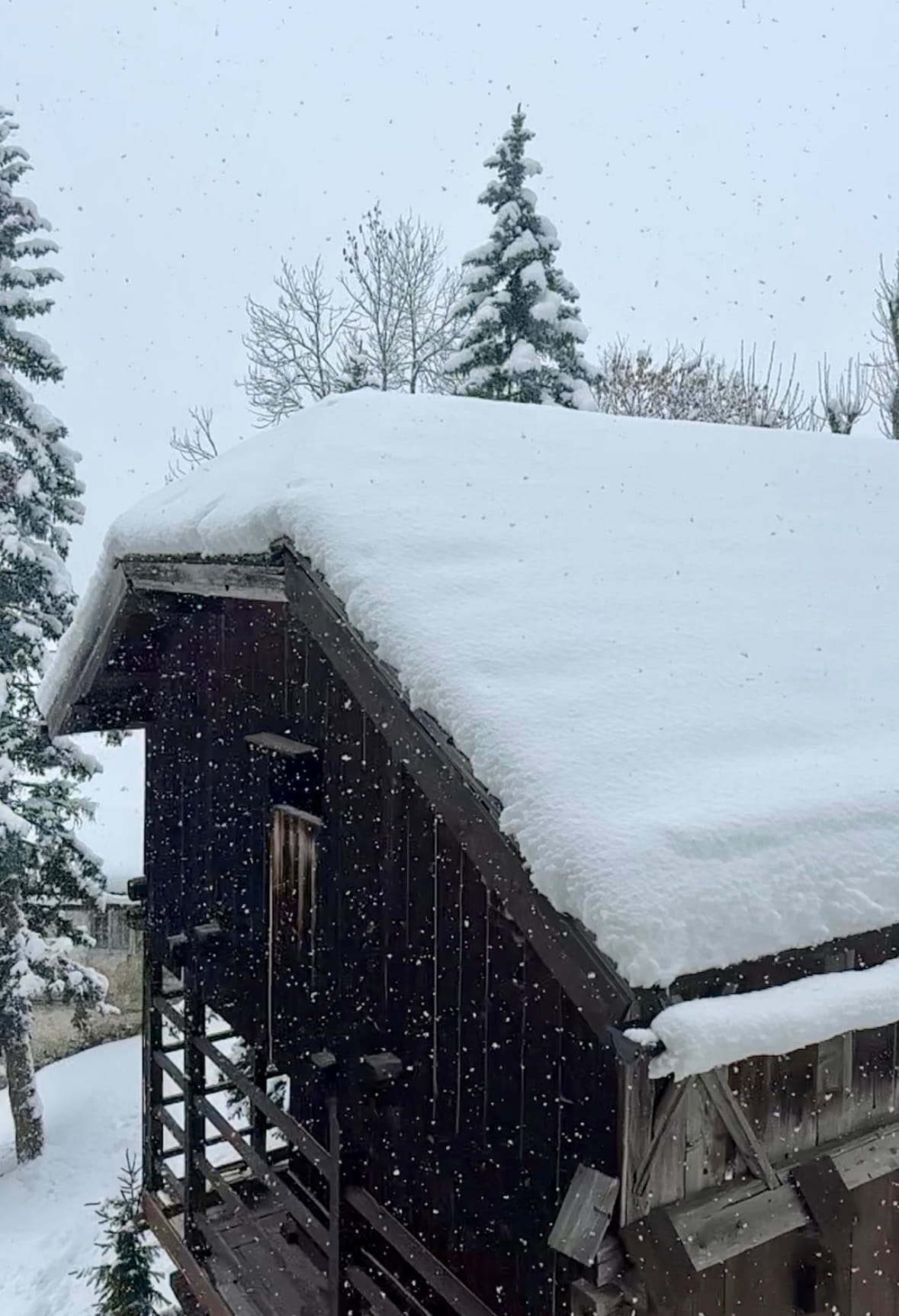
3 months agoSnowBrains Forecast: 1-2 Meters for Europe This Week - SnowBrains
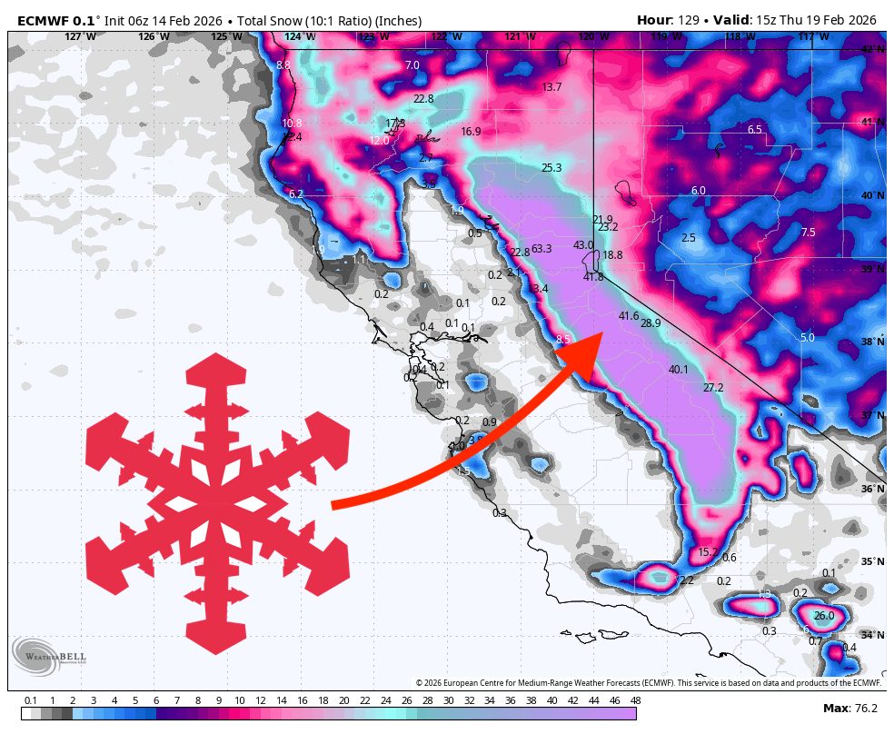
WeatherA multi-day storm cycle targets the Alps this week, then reloads with colder air next weekend while snow chances continue into midweek. The western Alps look like the main winners overall, with frequent snowfall pulses and the deepest totals at higher elevations. Snow levels run high enough at times midweek to keep lower villages on the edge of wet snow or rain, then they drop sharply heading into the weekend.
Snowboarding
Snowboarding
fromSnowBrains
3 months agoNozawa Onsen, Japan, Buried by 1.5 Meter Storm as Historic Snowfall Overwhelms Village - SnowBrains
Nozawa Onsen received about 150 cm of snow in just over 24 hours, producing extreme deep-snow skiing, village disruptions, widespread cleanup, and more snow expected.


fromSnowBrains
3 months agoSnowBrains Forecast: 6 Feet of Snow For Mt. Etna, Italy This Week - SnowBrains
WeatherA powerful early-week storm delivers very heavy snowfall to Mt. Etna, then tapers to lighter, higher-quality snow mid to late week as winds ease. Snow levels fluctuate between about 4,400 and 5,900 feet, so lower elevations may see some rain or mixed periods at times, while upper mountain conditions stay wintry with temperatures holding in the upper teens. The core of the storm arrives Monday night through Tuesday night with intense winds and denser snow.
Snowboarding
fromwww.dw.com
4 months agoGermany news: Snow storm moves south after blanketing north DW 01/10/2026
The Allgau region in the states of Bavaria and Baden-Wurttemberg is predicted to receive 20 to 30 cm (8 to 12 inches) of fresh snow by Saturday night, while the Black Forest could see as much as 50 cm, forecasters say. Long-distance train services in the north are expected to resume operations from 10 a.m. (0900 GMT), according to national rail operator Deutsche Bahn.
Germany news
fromwww.theguardian.com
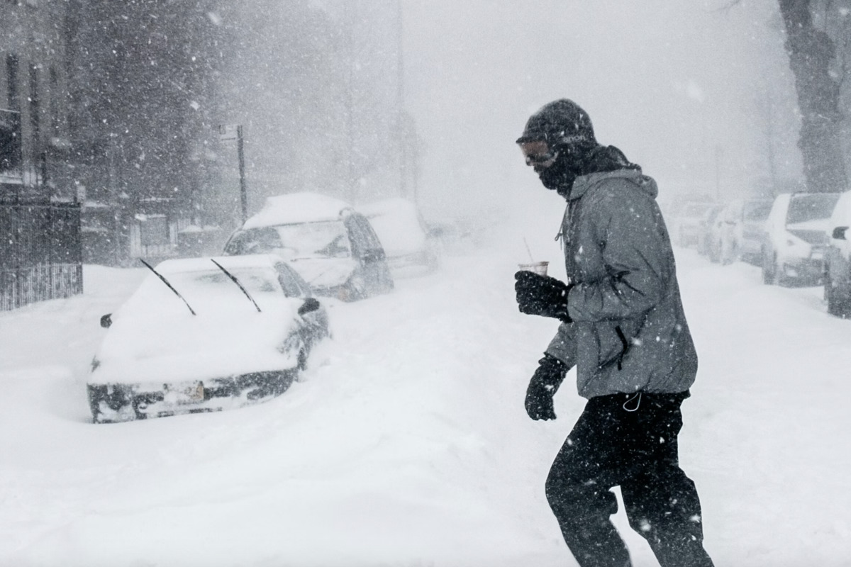
4 months agoWeather tracker: Arctic air grips Europe as severe winds batter Corsica
It has been a cold start to the year across much of Europe, particularly in central regions, where temperatures dropped to double-digit negatives. Heavy snowfall hit parts of eastern and central Europe on New Year's Eve, notably in Poland and Ukraine, with similar conditions across the Alps on the first few days of the year. The cold is likely to continue this week as an Arctic air mass sinks south across Europe, pulling temperatures well below the seasonal average outside south-east Europe.
France news
fromLondon Business News | Londonlovesbusiness.com
4 months agoSnow falls on parts of the UK and Met Office says blizzards to hit Scotland - London Business News | Londonlovesbusiness.com
This warning highlights the risk of disruptive snow showers and icy surfaces, particularly in northern and eastern areas, with impacts on travel and potential hazards for the public. We expect this cold spell to persist into the weekend and on into next week, with further warnings possible as temperatures remain well below average and snow showers continue in places.
UK news
Snowboarding
fromSnowBrains
5 months agoRevelstoke, BC, Buried in New Snow as Atmospheric River Brings Season Snowfall Total to 147" - SnowBrains
Revelstoke Mountain Resort has accumulated 374 cm of early-season snow and continues to receive heavy snowfall, increasing avalanche risk and limiting open terrain.
fromSFGATE
5 months agoThe Old Farmer's Almanac Predicts a Cold and Snowy Winter for Most Alaska Homeowners
The Old Farmer's Almanac 2025-2026 Winter Forecast calls the national outlook "mostly mild-with pockets of wild." Editor Carol Connare notes that while much of the U.S. will experience near-normal to slightly milder temperatures, Alaska remains one of those "pockets of wild." For Alaska homeowners, that means a winter true to form-long, cold, and snow-heavy from the coast to the interior.
Remodel
fromConde Nast Traveler
5 months ago7 Best Ski Resorts in Japan, Where Olympic Slopes Meet Traditional Onsens
As the snowiest country on Earth, Japan is a premier ski destination. Every winter, cold, dry air from Siberia passes over the warm Sea of Japan, where it picks up moisture and turns areas like the Japanese Alps, where annual snowfall often exceeds 400 inches, into a winter wonderland. And, with nearly 500 resorts packed into a country just slightly smaller than California, Japan is equipped to take full advantage of Mother Nature's bounty.
Skiing
[ Load more ]